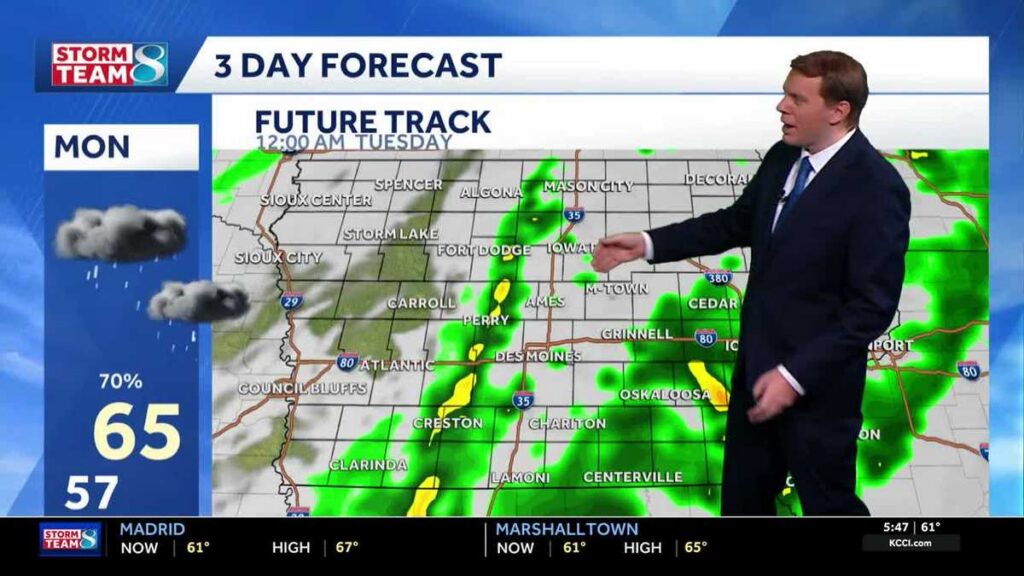
A stretch of quiet, mild weather is about to give way to a busy storm pattern across Iowa. Residents should prepare for multiple rounds of rain and thunder moving through the state starting Monday morning and lasting into early Tuesday.
Sunday brought a brief taste of sunshine before clouds moved back in, keeping most of Iowa in the low-to-mid 60s — temperatures that are above average for this time of year. Skies stayed dry through the afternoon and evening, but that calm is not expected to last. A strengthening storm system pushing into the Midwest will begin making its presence felt overnight, with winds picking up out of the south and gusting between 20 and 30 mph by Monday morning.
Iowans can track developing conditions in real time using Interactive Radar, check active Weather Alerts, and monitor live views from across the state through Skycams.
Monday: Rain and Thunder Move In
The first rain showers could arrive as early as sunrise Monday, and some rumbles of thunder are possible alongside them. The day will not be a washout in the traditional sense — expect alternating rounds of showers and storms with breaks of dry time scattered throughout. High temperatures will stay warm, topping out in the low-to-mid 60s despite the unsettled sky.
The situation becomes more active Monday evening. Showers and thunderstorms are expected to become more widespread after dark, with some heavier downpours likely during the overnight hours. Anyone with outdoor plans Monday evening should keep a close watch on conditions.
Tuesday Through the Weekend
Tuesday morning will bring a gradual tapering of shower coverage and intensity. More dry time is expected to open up by Tuesday afternoon. Temperatures will start mild — likely near the mid-60s — before cooler air pushes in by evening, nudging readings back down into the mid-50s.
Wednesday looks cloudy and noticeably chilly, with some lingering light showers or drizzle possible and highs potentially holding in the low 50s. The back half of the week offers improvement: partly sunny skies are expected to return Thursday and carry into the weekend, with temperatures climbing back into the upper 50s to low 60s.
Iowa Forecast at a Glance
Tonight: Cloudy early, then on-and-off rain showers develop overnight. Low near 57°F. Southeast winds at 10 to 20 mph.
Monday: Variable clouds with showers and scattered thunderstorms. High near 65°F. South-southeast winds at 15 to 25 mph.
Monday Night: Scattered thunderstorms in the evening, then mainly cloudy overnight with thunderstorms likely. Low near 64°F. South-southeast winds at 15 to 25 mph.
Tuesday: Early rain showers giving way to overcast skies through the day. High near 67°F. Southwest winds at 10 to 15 mph.