Iowa residents should prepare for a noticeable shift in weather over the coming days, as colder air sweeps in from Canada and temperatures drop well below what the region has seen this week. Here’s what forecasters are tracking and what you can expect through next week.
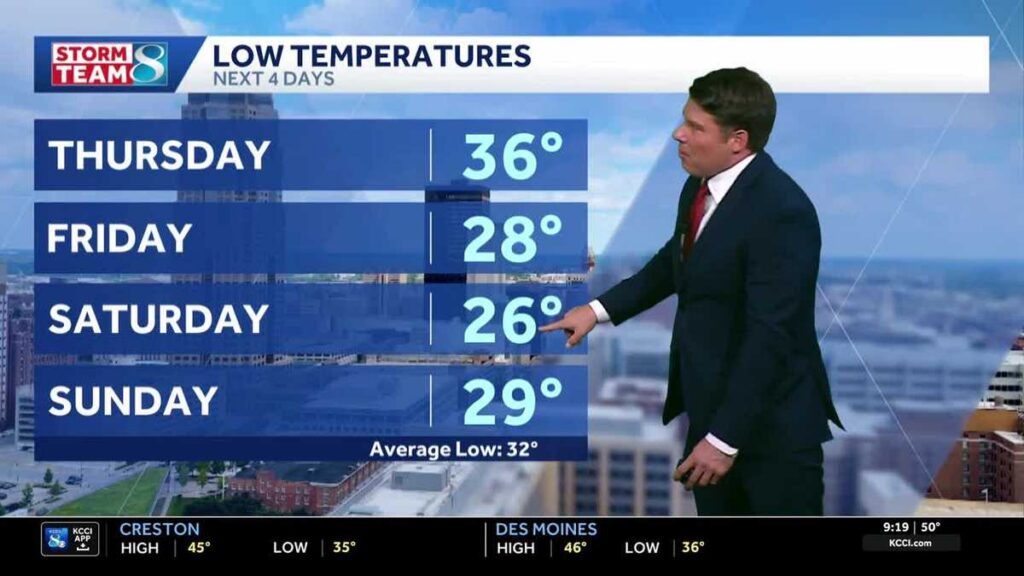
A fast-moving clipper system that brought morning showers to parts of the region has already pushed east into Wisconsin and Illinois. In its wake, northwest winds are ushering in significantly cooler air, with Thursday morning lows expected to settle in the mid-30s and afternoon highs reaching only the mid-40s.
Cold Snap Takes Hold Through the Weekend
High pressure building in from Canada will deepen the chill heading into the weekend. Friday, Saturday, and Sunday mornings are all forecast to drop into the middle 20s — cold enough to threaten frost and require extra precautions for those spending time outdoors. Afternoon highs are expected to remain stuck in the middle 40s through Sunday.
Iowans who want to monitor conditions in real time can check the Interactive Radar, review active Weather Alerts, or browse live aerial views from more than 25 locations across the state via the Skycams page.
Relief Arrives Early Next Week
Monday offers a break from the cold. With the large Canadian high pressure system still anchored overhead, skies are expected to be quiet and sunny, and temperatures should climb back into the 50s — a welcome rebound after several days of below-normal readings.
By Tuesday, a strong flow from the south will develop as a compact area of low pressure passes to the north of Iowa. That pattern should help push temperatures into the low-to-mid 50s and keep them there through the middle of the week. The southwest flow is then expected to strengthen further, lifting readings into the mid-to-upper 50s as the week progresses.
Potential Storm System Late Next Week
Forecasters are watching a possible weather system that could arrive by the end of next week, though models have not yet come into full agreement on the details. Early indications suggest the system could bring rain and possibly a storm or two, but confidence remains low at this range. Residents should continue monitoring forecasts as the week unfolds for more definitive guidance.
Iowa Daily Forecast
Today: Slim chance of a morning shower, mainly to the north and east, then partly to mostly sunny. Breezy conditions expected. High near 59°F. North-northwest winds at 15 to 20 mph with gusts up to 30 mph.
Tonight: Partly cloudy. Low near 37°F. North-northwest winds at 10 to 15 mph.
Tomorrow: Partly to mostly cloudy. High around 42°F. North winds at 10 to 15 mph with gusts up to 25 mph.
Tomorrow Night: Partly cloudy. Low near 28°F. North winds at 10 to 15 mph.